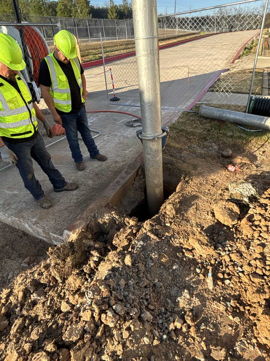
Verify What’s Below Before You Break Ground!
Inaccurate utility records lead to damaged infrastructure, costly delays, and safety incidents. Our professional potholing services, also known as daylighting or test holing, use hydro excavation technology to safely expose and verify the exact location, depth, and condition of buried utilities without risk of damage. Serving telecom providers, contractors, engineering firms, municipalities, and industrial facilities throughout Houston and Galveston.
Why Potholing Is Essential for Your Project
- Confirms exact utility depth and position eliminating reliance on outdated or inaccurate as-built records
- Prevents costly utility strikes that cause service outages, repair bills, and regulatory penalties
- Satisfies Subsurface Utility Engineering (SUE) requirements elevating utility data from Quality Level B to Quality Level A
- Protects your crews and the public by identifying hazards before mechanical excavation begins
- Reduces project change orders by providing verified field data for accurate engineering designs
- Meets Texas 811 compliance requirements and supports due-diligence documentation for project owners
- Minimizes surface disruption with small, precise excavation openings that restore quickly
Common Potholing Applications
| Application | Who Needs It | Why It Matters | Typical Scope |
|---|---|---|---|
| Pre-Construction Utility Verification | General contractors, civil engineers | Confirms utility locations before excavation or boring begins | 5–50+ potholes per project |
| Fiber & Telecom Route Clearance | ISPs, telecom providers, fiber contractors | Ensures safe horizontal directional drilling paths for new fiber/cable | Route-length verification |
| Gas & Electric Line Locating | Gas utilities, electric providers, pipeline companies | Verifies depth and clearance of high-consequence utilities | Targeted critical crossings |
| Municipal Infrastructure Mapping | Cities, MUDs, water authorities | Provides accurate data for capital improvement and GIS programs | Systematic grid potholing |
| Design-Phase SUE Support | Engineering firms, surveyors | Elevates utility data to Quality Level A for design accuracy | Project-specific scope |
| Pipeline Crossing Verification | Oil & gas, industrial facilities | Confirms safe separation distances at utility crossings | Per-crossing basis |
| Emergency Utility Exposure | All sectors | Rapidly locates and exposes utilities during urgent repair situations | As-needed response |
Our Potholing Process
- Project scoping and coordination reviewing plans, utility records, and One-Call (811) locate markings with your project team
- Site mobilization and safety setup establishing traffic control, work zones, and equipment positioning
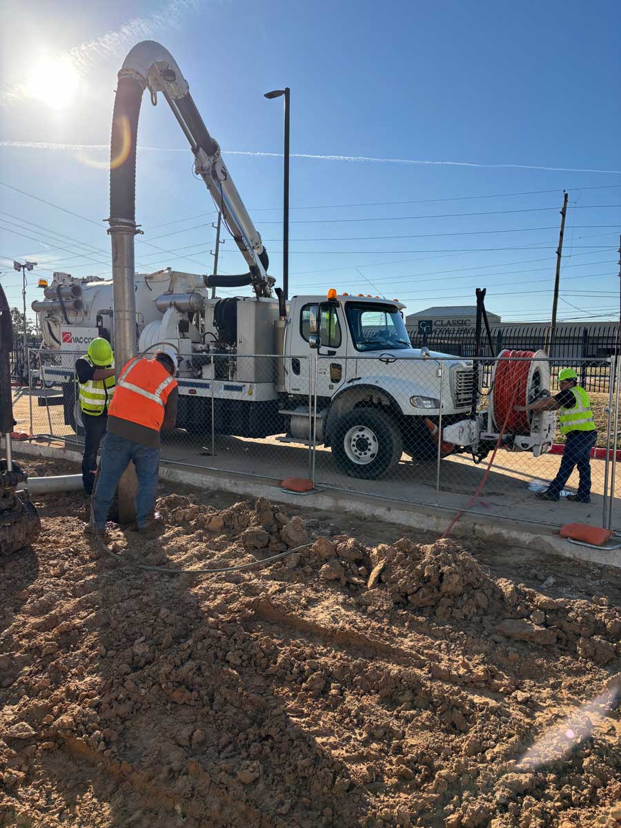
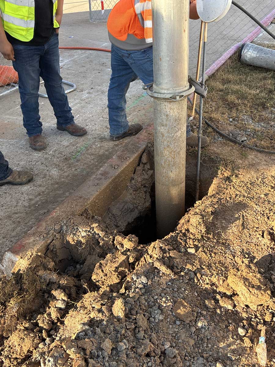
- Precision hydro excavation using controlled high-pressure water to create a small test hole directly over the target utility
- Simultaneous vacuum extraction removing the soil-water slurry into our holding tanks for a clean, visible exposure
- Utility identification and measurement recording utility type, material, diameter, depth, and horizontal position
- Professional documentation providing photographs, GPS coordinates, and detailed data sheets for your engineering records
- Backfill and surface restoration restoring the pothole with appropriate materials and returning the site to pre-work condition
Potholing vs. Traditional Utility Locating Methods
| TRADITIONAL METHODS | OUR HYDRO EXCAVATION POTHOLING |
|---|---|
| Surface-level electromagnetic and GPR locating only | Physical visual confirmation of actual utility position |
| Provides estimated horizontal location (Quality Level B) | Delivers precise depth, material, and position data (Quality Level A) |
| Cannot verify depth or utility condition | Exposes the utility for direct measurement and inspection |
| Limited accuracy in congested utility corridors | Effective even in dense, multi-utility environments |
| No protection against inaccurate records | Eliminates reliance on potentially outdated as-built data |
| Mechanical hand digging risks utility damage | Non-destructive water-based excavation protects infrastructure |
| Time-consuming manual exposure process | Rapid pothole completion, most holes finished in under an hour |
Industries and Clients We Serve
Telecom & Fiber Providers, Whether you’re building out 5G small cell networks, expanding fiber-to-the-home, or installing new conduit runs, our potholing services verify safe boring paths and crossing clearances so your crews can drill with confidence.
General Contractors & Civil Engineers, From highway projects to commercial site development, we provide the verified subsurface data your designs and excavation plans depend on. Our documentation integrates directly into your SUE and engineering workflows.
Municipalities & Water Authorities, We partner with cities, counties, MUDs, and utility districts across the Gulf Coast to verify aging infrastructure locations, support capital improvement projects, and maintain accurate GIS utility records.
Gas, Electric & Pipeline Companies, When crossing or working near high-consequence infrastructure, accurate utility verification isn’t optional. Our potholing services confirm safe clearances and provide the documentation your safety and compliance programs require.
Industrial Facilities, Refineries, chemical plants, and manufacturing complexes rely on our potholing services for safe utility exposure in congested underground environments where a single strike can shut down operations.
Frequently Asked Questions
What is potholing and how does it work? Potholing, also called daylighting or test holing, is the process of creating a small, precise excavation to physically expose and verify a buried utility. We use hydro excavation technology, which combines high-pressure water to loosen soil with powerful vacuum to remove it, creating a clean window to the utility without any risk of mechanical damage.
What’s the difference between potholing and standard utility locating? Standard locating uses surface-level methods like electromagnetic detection and ground-penetrating radar to estimate where utilities run horizontally. Potholing goes a critical step further by physically exposing the utility so you can see, measure, and document its exact depth, size, material, and condition. In Subsurface Utility Engineering terms, this elevates your data from Quality Level B to Quality Level A, the highest standard of accuracy.
How many potholes does a typical project require? It depends entirely on the scope. A simple crossing verification might need just one or two potholes, while a fiber route clearance or large civil project may require dozens across the corridor. We work with your project team to determine the most efficient potholing plan based on your design needs and risk areas.
How large is a typical pothole opening? Most potholes are roughly 12 to 18 inches in diameter at the surface, just large enough to visually confirm the utility. This small footprint means minimal surface disruption and faster restoration compared to mechanical excavation methods.
What kind of documentation do you provide? We deliver comprehensive pothole data sheets for each exposure, including GPS coordinates, measured depth, horizontal offset, utility type, material, diameter, and condition. Photographs document each exposure. This data package integrates directly into your SUE reports, engineering designs, and GIS records.
Do you coordinate with Texas 811 / One-Call? Yes. We work within the Texas One-Call system and coordinate with all locate markings on site. Our potholing service supplements the 811 process by physically confirming what the surface locates indicate, or revealing discrepancies before they become costly problems.
Can you pothole in congested areas with multiple utilities? Absolutely. Congested utility corridors are one of the primary reasons clients need potholing. Our hydro excavation method is specifically designed for safe work around multiple buried utilities, and our vacuum hoses can reach areas up to 400–600 feet from the truck to access tight or restricted locations.
Do you offer emergency potholing for utility strikes or urgent situations? Yes, we maintain 24/7 emergency response capabilities for urgent utility exposure needs. When a strike occurs or an emergency repair requires immediate utility verification, our team can mobilize quickly throughout Houston, Galveston, and Southeast Texas.
Get Accurate Utility Data Before Your Next Project
Contact Texas Hydrovac today for a free consultation on your potholing and utility locating needs. Our experienced operators and advanced hydro excavation equipment deliver the verified subsurface data that keeps your project safe, compliant, and on schedule. Serving Houston, Galveston, and throughout Southeast Texas.